
Carbondale- Sartoris
A Landscape Forged by Fire
The summer of 2003 was one of the hottest ever, and nowhere more so than in the expanse forest between Highway 3 and the Carbondale River. A summer-long wildfire vast stands of conifer trees and for some weeks the inferno threatened to consume the Municipality of Crowsnest Pass. Eventually the fire was smothered by the snows of winter.
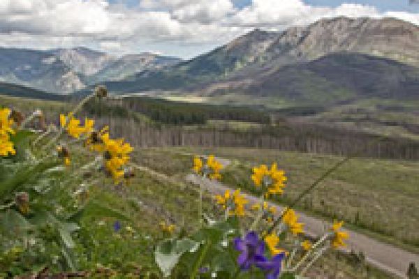
Loggers salvaged what they could from the scorched but still upright timber, creating a patchwork of blackened stands and open clearcuts. The burn area today is a colourful testament to the restorative role of wildfire. Bright young pine seedlings thrive in the cut blocks while bright red fireweed colonizes the remaining patches of dead forest.
Best of all are the natural rockeries of arrowhead balsamroot, lupine, larkspur, and other native wildflowers exploiting the nourishment and light legated by the great fire.
Sartoris Road from Crowsnest Pass south to the Carbondale River affords an intimate view of this rejuvenated landscape.
Waypoints
From Main Street in the Crowsnest Pass community of Blairmore, follow 133 Avenue across the railway tracks (GPS N49 36.438 W114 26.000) and continue to 131 Street. Turn west and follow the sharpish uphill bend to the end of asphalt and the start of Sartoris Road (GPS N49 36.225 W114 26.237).
From here on, the road is surfaced with gravel, not always well-graded. Continue south along Sartoris Road to its end at a T-intersection with Township Road 61A (GPS N49 27.252 W114 24.559). From there, you may follow the gravelled road east to its junction with Highway 507 (GPS N49 30.583 W114 12.115).